


Fish-eye view of Mars centered at 180 degrees West longitude. From Viking 1 orbiter survey images, 1980. (Courtesy NASA/JPL and USGS-Flagstaff).
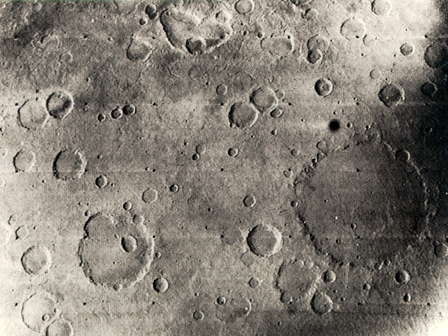
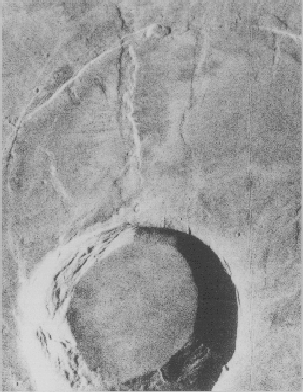
1969 Mariner 6 view of the Sinus Sabaeus and Deucalionis Regio portion of Mars. The large crater (lower right) is Flaugergues (~200 km diameter; 18 S, 341 W). The double crater toward the lower left is Wislicenus (18 S, 348 W). (Mariner 6 image 6N21; courtesy NASA/JPL).
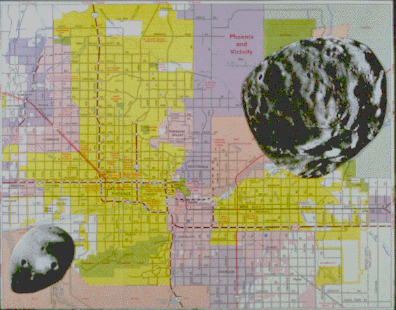
Deimos (left) and Phobos (right) compared with a map of the Phoenix, Arizona area. (Phobos and Deimos images courtesy NASA. This figure was produced by Steven Schmidt).
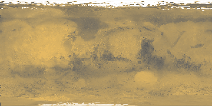
Mars global color, compiled from Viking images. Longitude 0 runs down the middle of the image. Longitude 180 is on both right and left sides. Latitude 90 N is at top, 90 S at bottom. Simple Cylindrical Projection. (Courtesy U.S. Geological Survey, Astrogeology Branch, Flagstaff, Arizona).
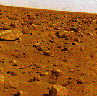
Example of Viking lander site on Mars. Two Viking landers arrived on Mars in 1976.(NASA/JPL).
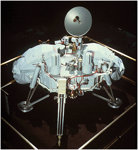
Viking lander. Two Vikings, sent by the United States, landed on Mars in 1976. The Soviet Union also sent landers to Mars. None of the Soviet landers were successful in returing images of the Martian surface, although at least one of these (Mars 3) was the first spacecraft to soft-land on Mars in 1971.
Both Russia and the U.S. plan to send landers to Mars in the 1990's decade. Mars 94 is an international mission headed by Russia that, has recently had it's launch date changed to 1996. The U.S. going to launch Pathfinder, a small lander with an even smaller roving vehicle. Pathfinder is scheduled for launch in 1996 and land on Mars July 4, 1997-- more than TWENTY years after the Vikings touched down.
(Photo courtesy the National Air and Space Museum, Smithsonian Institution, Washington, DC. This model is on display there).
Pavonis Mons summit region. Pavonis is one of the large Tharsis shield volcanoes. (Photo: NASA)
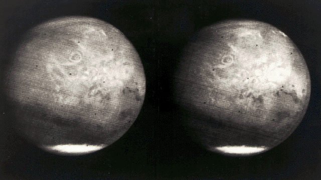
Mariner 7 images of Mars taken on approach to the Red Planet in August 1969. The circular feature in the upper-center of each frame is the 25 km-high volcano, Olympus Mons. At the time, however, it was not known that this feature is a volcano. Instead, scientists assumed it was a big impact crater. The dark squiggly features at the center-right (especially in the right frame) represent Valles Marineris, a giant canyon system that would stretch the distance from Los Angeles to New York. Again, when Mariner 7 took these pictures, no one suspected that this was a canyon. The south polar cap is also visible in this frame. The canyons and volcanoes of Mars would not be "discovered" until Mariner 9 photographed them in 1972. (Courtesy NASA/JPL).

Malin Space Science Systems (MSSS) of San Diego, California, has more Mars images to look at. In particular, MSSS has an archive of Viking orbiter images that can be searched by clicking your cursor on a map of Mars.
Link back to Life Magazine Space Shuttle Challenger Tribute Page (placed at their request).